
Key Takeaways
- Flood Resilience is the Core Goal – The ~$400M project elevates 1.8 miles of I-10 (Heights Blvd to I-45) above White Oak Bayou’s 100-year floodplain. Flooded 10+ times since 1992 (Harvey, Allison, Imelda). Keeps the corridor open in storms; includes a 26-acre detention pond.
- Safety and Multi-Modal Upgrades – Rebuilds HOV lanes and the strike-prone Houston Avenue Bridge (now under elevated I-10). Adds a 2-mile, 10-ft shared-use path for pedestrians/cyclists. Pure resiliency project—no added vehicle capacity.
- Construction Progress and Impacts – Started early 2025; targets mid-late 2028. June 2026: Phase 1 westbound advancing; Taylor St ramp opened April 2026. Ongoing 2-lane limits, connector closures (some to 2028), and nightly ramp/street work.
The I-10 White Oak Bayou Elevation Project is a multi-year construction effort to raise a flood-prone stretch of the Katy Freeway above White Oak Bayou, ensuring the vital corridor remains open during major storms while enhancing safety and multi-modal access.
Project Overview and Purpose
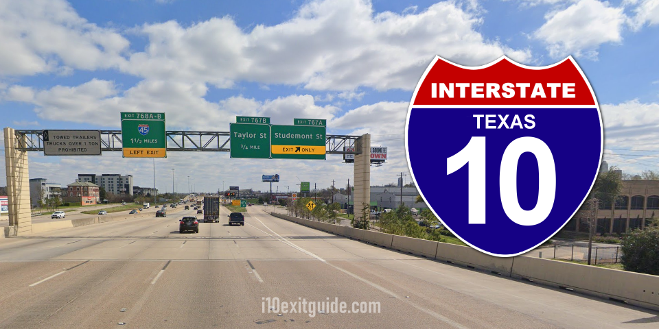
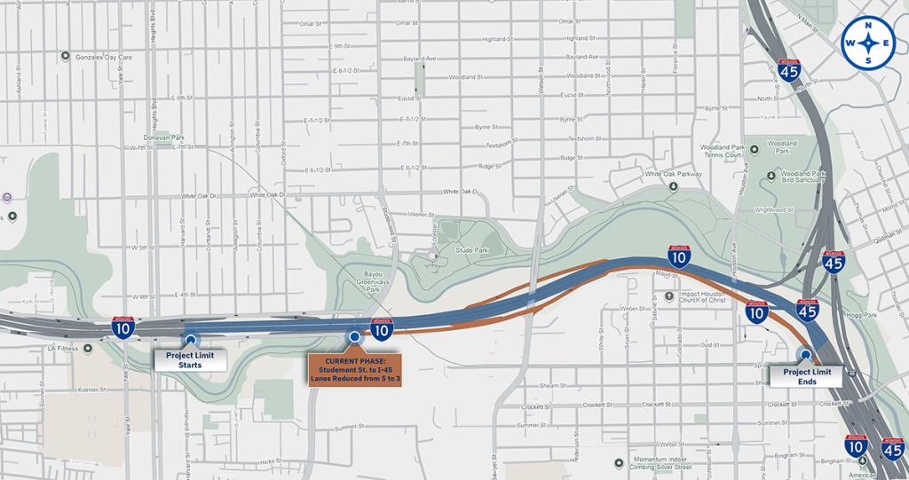
Spanning approximately 1.8 miles from Heights Boulevard to I-45, the project elevates the existing I-10 mainlanes out of the 100-year floodplain. It reconstructs the high-occupancy vehicle (HOV) lanes and replaces the frequently struck Houston Avenue Bridge, which will sit beneath the new elevated mainlanes. Additional features include a roughly two-mile, 10-foot-wide shared-use path for pedestrians and cyclists connecting to existing trails, plus a 26-acre detention pond beneath the elevated structure. 1
Cost estimates range from $400 million to $407 million, with funding support including the Texas Clear Lanes initiative. Construction began in early January 2025 following a ceremonial groundbreaking, with Webber LLC serving as the primary contractor. Full completion is anticipated in mid-to-late 2028, though some reports extend expectations toward the end of 2029. 2
The need is clear and urgent. This section of I-10 has flooded at least 10 times since March 1992, including during Tropical Storm Allison, Hurricane Harvey, and Tropical Storm Imelda. These events rendered the freeway impassable, disrupting freight, commuting, and emergency response on one of the nation’s busiest multi-state corridors. The project brings the roadway into compliance with federal 50-year and TxDOT 100-year storm standards. 1
Why Elevation Matters for Houston’s Resilience
Raising the mainlanes prevents White Oak Bayou overflow from closing this key link. The detention pond adds stormwater storage capacity, while the new bridge design eliminates low-clearance strikes that have plagued Houston Avenue. The shared-use path improves connectivity between neighborhoods, businesses, and greenways without expanding vehicle capacity—this remains a pure resiliency project.
Current Construction Progress (as of Late 2026)
As of the most recent detailed TxDOT quarterly update in June 2026, crews were advancing steadily through Phase 1 (specifically Step 4B). Significant work focused on the westbound mainlanes between I-45 and Studemont Street. A major milestone arrived in April 2026 with the opening of the new Taylor Street entrance ramp, which improved westbound access and traffic flow. Repairs to the MKT Trail bridge were also completed and the bridge reopened to the public. 2
Ongoing activities include:
- Construction of westbound I-10 frontage road pavement and bridges (foundations, drilled shafts, columns, beams, decks, and paving).
- Building the southbound I-45 to westbound I-10 direct connector and associated HOV direct connector bridges.
- Work on the westbound exit ramp to Heights Boulevard and the entrance ramp from Studemont Street.
- Installation of the new Shared-Use Path (SUP) along the corridor (segments remain closed to the public during active construction).
By September 2026, with summer closures referenced in the June update having concluded or transitioned, the project continues in active construction mode. Drivers and residents should monitor Houston TranStar and TxDOT Houston channels for the latest patterns, as no newer comprehensive public quarterly had been widely posted by late September. Progress remains on track overall, with TxDOT emphasizing safe, efficient delivery and opportunities to accelerate where feasible.
Traffic Impacts and Closures
Drivers continue to experience significant but managed disruptions. Long-term reductions have kept westbound I-10 mainlanes between I-45 and Taylor Street/Houston Avenue at two through lanes for extended periods. The northbound I-45 connector to westbound I-10 has operated with reduced capacity. The southbound I-45 direct connector to westbound I-10 (including HOV) faced total closure targeted through summer 2026, while the I-10 eastbound direct connector to I-45 northbound is expected to remain closed into mid-2028 as reconstruction proceeds in phases. 2
Nightly intermittent closures affect alternating entrance/exit ramps, Studemont Street, Taylor Street, Houston Avenue, and sections of the westbound frontage road for paving and bridge work. Detours are clearly posted, with recommended routes via I-610, US 59, or local streets such as Hardy and Providence for certain movements. Trail users face ongoing or intermittent closures on portions of the White Oak Bayou Greenway, with detours in place through much of the project timeline.
Expected Benefits and Next Steps
Once complete, the elevated I-10 will stay passable during heavy rainfall and major storms that previously shut it down. The reconstructed Houston Avenue Bridge will sit safely below the freeway, ending strike incidents. The shared-use path and improved connectivity will support daily multi-modal travel, while the detention features bolster broader flood resilience.
Looking ahead, construction will progress through remaining phases of mainlane elevation, connector rebuilds, bridge work (Houston Avenue demolition and reconstruction targeted around 2027), and final amenities. TxDOT continues public engagement, including earlier 2026 hearings focused on the shared-use path, and maintains active communication via its project website, social channels, and Houston TranStar.
What’s I-10 traffic like RIGHT NOW? I-10 Real-time traffic information for selected cities along I-10. Maps show updates on road construction, traffic accidents, travel delays and the latest traffic speeds. Traffic cameras show congestion at a glance. Visit I-10 Traffic.
The I-10 Exit Guide is the Internet’s largest and most complete website dedicated to Interstate 10 travelers. Find detailed exit service listings… lodging, camping, food, gas and more for every exit from California to Florida!
On the road? Why not take us with you. The I-10 Exit Guide is mobile-friendly and totally FREE. No App Required.
Traveling another route? Visit our growing family of exit guides: I-4 Exit Guide, I-5 Exit Guide, I-10 Exit Guide, I-75 Exit Guide, I-80 Exit Guide and I-95 Exit Guide. Detailed exit service listings… discount lodging, camping, food, gas and more for every exit along the way!