

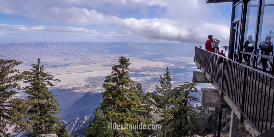
Key Takeaways
- Three day trips showcase Southern California’s variety: Explore Joshua Tree’s desert landscapes, the Palms to Pines route through Idyllwild, or the Redlands–Big Bear–Oak Glen loop.
- Each trip itinerary starts and ends at I-10: Estimated road trip times range from 6 to 9 hours, including driving and stops.
- The routes combine scenery with local attractions: Road trip highlights include national park viewpoints, mountain lakes, historic sites, botanical gardens and apple orchards.
I-10 serves as one of North America’s most iconic transcontinental highways, stretching across the southern tier of the United States from coast to coast. As it cuts through the Golden State, it offers drivers a front-row seat to some of the most dynamic, diverse, and striking landscapes in North America. However, simply staying on the interstate means missing out on the rich cultural heritage, dramatic alpine elevation shifts, and mesmerizing desert ecosystems that lie just minutes away from the asphalt corridor. Planning a curated California road trip off this major highway allows travelers to unlock hidden gems without straying too far from their primary driving route.
Whether you are a local seeking a weekend getaway or a cross-country driver looking to break up a long cross-country haul, taking an I-10 road trip detour provides an unforgettable glimpse into Southern California’s natural beauty. Within just a short drive from key freeway exits, you can transition from high-desert Joshua tree forests to alpine pine woods, historical boomtowns, and lush mountain orchards. Each single-day itinerary featured in this guide has been crafted to begin and end at an official I-10 exit, allowing for seamless travel integration while maximizing your sightseeing potential.
By setting out on a single-day road trip, you turn a standard drive into an extraordinary travel experience. From the sweeping vistas of the San Jacinto Mountains to the ancient rock formations of the Mojave Desert and the historic charm of mountain villages, these three distinct drive itineraries highlight the sheer variety of experiences awaiting you just off the highway. Pack your sunscreen, fill up your tank, and prepare to explore three exceptional single-day routes that showcase the absolute best of Southern California.
Trip 1: The High Desert & Joshua Tree Wilderness Loop
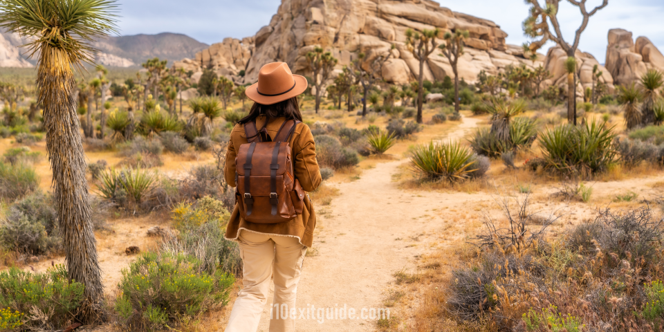
Route Details
- Starting Point: I-10 Exit 117 (CA-62 / Hwy 62 – Yucca Valley / Joshua Tree)
- Ending Point: I-10 Exit 173 (Chiriaco Summit / Cottonwood Spring Road)
- Route Path: North on CA-62 East through Desert Hot Springs, Yucca Valley, and Pioneertown; Enter Joshua Tree National Park via the West Entrance Station (Park Boulevard); Continue south along Park Blvd and Pinto Basin Road; Exit the park via Cottonwood Spring Road south to merge back onto I-10 East at Exit 173.
- Estimated Time: 7 to 9 hours (including driving and stopping time)
Road Trip Overview
This incredible desert road trip route takes you off the low valley floor of Interstate 10 and ascends into the enchanting high-desert landscapes of the Mojave and Colorado Deserts. Leaving the busy interstate at Exit 117, you will immediately notice a change in topography and climate as California State Route 62 climbs into the Morongo Basin. The drive presents expansive views of wind turbines, open desert floors, and rugged granite peaks towering in the background. As you travel through Yucca Valley, the air turns crisp and dry, setting the stage for an extraordinary California road trip experience.
The centerpiece of this road trip is Joshua Tree National Park, a ecosystem where two distinct desert systems converge. Driving along Park Boulevard, you will weave through otherworldly boulder fields, ancient rock outcroppings, and endless forests of iconic Yucca brevifolia (Joshua trees). The visual transformation from the quirky, artistic towns of Pioneertown and Joshua Tree into the serene, silent expanses of the national park is breathtaking.
As you navigate south through the park toward the Colorado Desert portion of the drive, the vegetation shifts dramatically. High-desert Joshua trees give way to thickets of ocotillo and golden cholla cacti. The road meanders gently through vast alluvial fans and quiet valleys, offering complete solitude away from modern distractions. Finishing your road trip at Chiriaco Summit provides a satisfying historical touchpoint before returning seamlessly to your I-10 road trip.
Key Stops Along the Route
Cabot’s Pueblo Museum
67616 Desert View Ave, Desert Hot Springs, CA 92240
Cabot’s Pueblo Museum is an architectural marvel and a monument to American homesteading spirit located just minutes north of I-10. Built by adventurer Cabot Yerxa starting in 1913, this multi-story Hopi-style pueblo was constructed entirely out of reclaimed materials, telephone poles, and salvaged timber found across the desert. The structure spans four stories, houses 35 rooms, and features 150 windows and 65 doors, serving as a testament to creative engineering. Visitors can explore the maze-like interior, which is filled with Native American artifacts, historical photographs, and early 20th-century memorabilia. The surrounding grounds feature drought-tolerant desert landscaping, traditional art installations, and breathtaking views of the Coachella Valley below. A stop here offers profound insight into early California homestead history, setting an inspiring, culturally rich tone for your high-desert excursion before heading further up into the Morongo Basin.
Pioneertown Mane Street
53688 Mane St, Pioneertown, CA 92268
Step back in time into the Old West with a visit to Pioneertown, a living movie set constructed in 1946 by Hollywood legends like Roy Rogers, Gene Autry, and Russell Hayden. Originally designed as a functioning 1880s Western town that double-functioned as a filming location and living space for movie crews, Pioneertown maintains its rustic charm today. Stroll down dirt-paved “Mane Street” to view frontier-style saloon facades, historic jails, bank buildings, and artisan craft shops. Local merchants offer handcrafted leather goods, pottery, and unique desert souvenirs. Pioneertown is also home to Pappy & Harriet’s Pioneertown Palace, a legendary music venue and mesquite barbecue joint that has hosted famous musicians from around the globe. This unique road trip destination blends Hollywood history with high-desert counter-culture, providing a memorable, picture-perfect stop along Highway 62 before you venture directly into Joshua Tree National Park.
Keys View
Keys View Rd, Joshua Tree National Park, CA 92277
Situated at the crest of the Little San Bernardino Mountains inside Joshua Tree National Park, Keys View delivers one of the most stunning panoramic vistas in Southern California. Reached via a scenic paved side road off Park Boulevard, this high-elevation lookout point sits at over 5,000 feet above sea level. On a clear day, road trippers are rewarded with breathtaking sweep-around views of the entire Coachella Valley, the San Andreas Fault Line, Mount San Jacinto, and the distant, shimmering surface of the Salton Sea. On exceptionally clear winter days, you can even spot Signal Mountain in Mexico. Interpretive signs along the paved walkway explain the complex geological forces that formed the fault lines and mountain ranges visible below. It is an ideal spot for photography, geological appreciation, and taking in the sheer vastness of the desert landscape during your afternoon drive.
Cholla Cactus Garden
Pinto Basin Rd, Joshua Tree National Park, CA 92277
Located precisely at the transition zone between the higher Mojave Desert and lower Colorado Desert, the Cholla Cactus Garden features a dense, naturally occurring stand of Teddy Bear Cholla (Cylindropuntia bigelovii). A well-maintained 0.25-mile flat wooden boardwalk loops directly through this surreal, fuzzy-looking cactus forest. Despite their soft appearance, these plants possess microscopic barbs that catch easily, giving them the nickname “jumping cacti.” During the golden hour of mid-afternoon or late morning, sunlight filters through the needle spines, causing the entire field to glow with a brilliant halo effect. The stark contrast between the bright green-and-yellow cacti and the dark, volcanic mountain backdrops makes this one of the most photogenic quick stops along the Pinto Basin Road. Walking along the wooden path provides an up-close look at delicate desert plant life while ensuring safety and ecological protection.
General Patton Memorial Museum
62510 Chiriaco Rd, Chiriaco Summit, CA 92201
Located right at I-10 Exit 173, the General Patton Memorial Museum honors the life of General George S. Patton Jr. and the soldiers who trained at the Desert Training Center during World War II. Established in 1988, the museum stands on the former site of Camp Young, which was the headquarters for the vast desert military complex created to prepare American troops for combat in North Africa. Outdoors, visitors can inspect an impressive collection of mid-20th-century military tanks, armored vehicles, and artillery pieces. Inside, the climate-controlled exhibition halls display uniforms, tactical gear, historical weapons, letters, and detailed dioramas documenting military campaigns from WWII through modern conflicts. Visiting this museum offers a poignant, educational end to your high-desert circuit, delivering rich historical context before you seamlessly merge back onto your primary I-10 route.
Trip 2: The Palms to Pines Scenic Byway & Mountain Escape

Route Details
- Starting Point: I-10 Exit 111 (CA-111 / Palm Springs / Whitewater)
- Ending Point: I-10 Exit 100 (CA-243 / Hargrave Street – Banning)
- Route Path: South on Highway 111 through Palm Springs and Palm Desert; Turn right onto CA-74 West (Palms to Pines Highway) ascending into the Santa Rosa and San Jacinto Mountains; Continue onto CA-243 North through Idyllwild; Descend the mountain north on CA-243 directly to I-10 at Exit 100.
- Estimated Time: 6 to 8 hours (including driving and stopping time)
Road Trip Overview
Few road trip routes in North America display such drastic ecological contrast over such a short distance as the Palms to Pines Scenic Byway. Starting from I-10 near Palm Springs, this magnificent California road trip transitions from hot desert valley terrain to cool, alpine evergreen pine forests in less than an hour of driving. Exiting at Highway 111, you begin by traveling through the resort communities of the Coachella Valley, surrounded by towering fan palms, mid-century modern architecture, and dramatic mountain backdrops.
The primary thrill of this road trip route begins in Palm Desert, where you turn onto California State Route 74. The road immediately begins an ambitious, winding ascent up the face of the Santa Rosa Mountains. As you navigate famous switchbacks like the Seven Level Hill, the low desert floor drops away beneath you, revealing breathtaking vistas of the entire urban valley basin. The ambient temperature drops steadily with every thousand feet of elevation gained, transforming the landscape from cactus-studded scrublands to sub-alpine oak, cedar, and Jeffrey pine forests.
As you pass through Mountain Center and transition onto Highway 243, you enter the heart of the San Jacinto Mountains. The tranquil arts village of Idyllwild offers a peaceful, forest-sheltered respite perfect for lunch and exploration. The final leg of the drive along Highway 243 descends Northern San Jacinto mountain ridges, framing spectacular views of San Gorgonio Pass and the San Bernardino Peak before ending smoothly back on I-10 in Banning.
Key Stops Along the Route
Moorten Botanical Garden
1701 S Palm Canyon Dr, Palm Springs, CA 92264
Located along Highway 111 in South Palm Springs, the historic Moorten Botanical Garden is a charming, family-owned living museum established in 1938. Spanning one acre, this hidden gem contains over 3,000 species of desert cacti, succulents, and arid-climate plants collected from across the globe. The property is thoughtfully organized into regional geographic habitats, including the Sonoran, Mojave, South American, and African deserts. A centerpiece of the garden is the world’s first “Carium”-a specialized glass greenhouse filled with rare, delicate desert flora and unusual desert plant specimens. Shaded pathways wind beneath mature desert trees, past ancient fossils, and alongside tranquil rock features. Taking a peaceful morning stroll through Moorten Botanical Garden provides a fantastic introduction to desert botany before your vehicle climbs up into the cool, forested elevations of the Santa Rosa and San Jacinto Mountains.
The Living Desert Zoo and Gardens
47900 Portola Ave, Palm Desert, CA 92260
The Living Desert Zoo and Gardens is an acclaimed non-profit conservation park dedicated to preserving the world’s desert ecosystems. Located just minutes off Highway 111 in Palm Desert, this 1,200-acre facility blends wildlife habitats with botanical garden paths. Visitors can see native and exotic desert animals up close, including cheetahs, rhinos, giraffes, desert bighorn sheep, and fennec foxes. The park features interactive experiences like hand-feeding giraffes, exploring open-air aviaries, and walking through native flora exhibits representing North American and African deserts. Immaculate hiking trails extend into the pristine desert mountain foothills behind the facility for those seeking extra activity. It is an educational, inspiring stop that highlights the astounding resilience of desert life before you leave the valley floor and begin ascending the steep mountain switchbacks of the Palms to Pines Byway.
Coachella Valley Vista Point
CA-74, Palm Desert, CA 92260
Perched dramatically on a sharp turn along Highway 74, the Coachella Valley Vista Point offers one of the most stunning lookout views in Southern California. As you climb the steep switchbacks from Palm Desert, this large paved pullout allows drivers to safely stop and take in the panoramic scope of the valley floor below. From this viewpoint, you can observe the precise geometric layout of valley cities, golf courses, green oases, and the sprawling San Andreas Fault zone cutting across the desert basin. Looking directly below, you can watch cars trace the snake-like curves of the mountain highway you just traveled. On clear days, the view stretches across to the Little San Bernardino Mountains and Joshua Tree National Park. Excellent interpretive signs explain the geological formations and human development of the Coachella Valley, making it a mandatory photographic stop on your I-10 road trip.
Idyllwild Nature Center
54000 Pine Crest Ave, Idyllwild, CA 92549
Tucked deep within the scented pine forests just outside the mountain village of Idyllwild, the Idyllwild Nature Center offers a peaceful haven for outdoor recreation and environmental education. Situated at an elevation of over 5,400 feet, this county park features a modern museum with interactive exhibits detailing local wildlife, forest ecology, and Cahuilla Native American culture and history. Well-maintained, easy-to-moderate hiking trails wind outward from the center through incense cedars, ponderosa pines, and serene mountain meadows. In spring, wildflowers bloom along small streams, while autumn brings brilliant gold colors to the black oak canopy. Birdwatchers will delight in spotting mountain chickadees, Steller’s jays, and red-breasted sapsuckers. The tranquil facility is an ideal destination to stretch your legs, breathe in fresh alpine mountain air, and experience the complete ecological contrast of this high-elevation mountain detour.
Lake Fulmor
CA-243, San Jacinto Mountains, Mountain Center, CA 92561
Situated directly off scenic Highway 243 between Idyllwild and Banning, Lake Fulmor is a picturesque three-acre mountain lake framed by pine trees and white firs. This tranquil day-use area features a paved, fully accessible walking trail that circles the perimeter of the water, crossing over a wooden footbridge and leading to quiet picnic spots equipped with tables and BBQ grills. The mirror-like surface of the lake reflects the surrounding alpine trees and sky, creating fantastic photography opportunities year-round. It is a popular spot for birdwatching, dragonflies, and gentle fishing for stocked rainbow trout. In the cooler fall months, vibrant autumn leaves highlight the shoreline. Taking a brief break at Lake Fulmor offers a serene, cooling pause as you begin your final descent down the northern slopes of the San Jacinto Mountains back toward I-10.
Trip 3: Historic Redlands, Big Bear Mountain & Oak Glen Loop
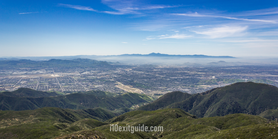
Route Details
- Starting Point: I-10 Exit 80 (CA-38 / Orange Street – Redlands)
- Ending Point: I-10 Exit 85 (Yucaipa Boulevard – Yucaipa)
- Route Path: Depart I-10 at Exit 80 onto CA-38 East through historic Redlands and up into the San Bernardino National Forest; Drive past Onyx Summit to Big Bear Lake via Highway 38; Take CA-18 West along the Rim of the World Highway to Running Springs; Turn south on CA-330, then cut through Yucaipa/Oak Glen Road to complete the loop at I-10 Exit 85.
- Estimated Time: 7 to 9 hours (including driving and stopping time)
Road Trip Overview
This high-altitude road trip showcases historic Southern California architecture, major mountain summit driving, shimmering alpine lakes, and agricultural valleys. Commencing from I-10 in the city of Redlands, this California road trip immediately introduces you to rich turn-of-the-century citrus heritage before taking you up into the San Bernardino Mountains along Highway 38. Highway 38 is widely regarded as the quieter, more scenic wilderness highway into Big Bear, offering gentle curves, expansive forest valleys, and dramatic alpine views.
As you ascend, the highway climbs past Mill Creek Canyon and winds up toward Onyx Summit, which stands as one of the highest paved highway passes in Southern California at over 8,400 feet above sea level. Passing through alpine forests and sub-alpine meadows, the drive eventually drops into the high-altitude valley containing Big Bear Lake. Here, brilliant blue water is framed by snow-capped peaks in winter or lush green forests in summer.
After spending time around Big Bear Lake, the return leg of this road trip follows Highway 18-the world-famous “Rim of the World Highway.” This road hangs dramatically along the cliff edges of the mountain range, offering sweeping views of the entire Inland Empire basin below. The trip concludes with a delightful descent through the historic apple orchards of Oak Glen before returning to I-10 at Exit 85 in Yucaipa.
Key Stops Along the Route
Kimberly Crest House & Gardens
1325 Prospect Park Dr, Redlands, CA 92373
Located just a short drive off I-10 in historic Redlands, Kimberly Crest House & Gardens is a pristine example of French Chateauesque architecture from the late Victorian era. Constructed in 1897, this 6,100-square-foot, three-story mansion sits on six acres of beautifully manicured Italianate gardens, featuring stone terraces, lily ponds, koi-filled fountains, and classic statuary. The property was once owned by J. Alfred Kimberly, co-founder of the Kimberly-Clark paper company. road trippers can explore the interior of the home, which remains fully furnished with original period antiques, elaborate woodwork, and historical family heirlooms. The surrounding citrus groves pay homage to Redlands’ historic identity as a powerhouse of the California navel orange industry. Stopping here provides a grand, culturally rich departure point before your road trip climbs into the wild alpine reaches of the San Bernardino Mountains.
Onyx Summit Overlook
CA-38, Angelus Oaks, CA 92305
Reaching an elevation of 8,443 feet above sea level, Onyx Summit is the highest point on California State Route 38 and one of the highest paved highway passes in Southern California. Located deep within the San Bernardino National Forest, this scenic high-elevation pullout offers breathtaking views across pristine mountain wilderness, deeply forested canyons, and distant alpine peaks like San Gorgonio Mountain (the highest peak in Southern California). The crisp, thin mountain air and fragrant pine foliage provide an invigorating atmospheric change from the suburban valleys far below. Large gravel pullouts allow drivers to safely stop, stretch, and capture stunning photos of the sweeping high-country terrain. It is a spectacular geographic milestone along your drive, highlighting the remarkable elevation gain made possible on a single-day road trip originating from Interstate 10.
Alpine Slide at Magic Mountain
800 Wildrose Ln, Big Bear Lake, CA 92315
Located near the heart of Big Bear Lake Village, the Alpine Slide at Magic Mountain offers year-round outdoor entertainment for visitors of all ages. The park’s main attraction is Southern California’s only authentic bobsled experience, where riders take a chairlift to the top of the peak and navigate individual sleds down a long, winding cement track using handbrakes to control their speed. During winter months, the park features a snow tubing hill serviced by a covered Magic Carpet moving walkway. In summer, visitors can enjoy a water slide, a go-kart track, and a mini-golf course. The elevated location provides scenic views of Big Bear Lake and the surrounding pine forest. It serves as an action-packed, refreshing stop to stretch your legs and enjoy fun outdoor activities during your mid-day break in the high country.
Rim of the World Scenic Byway Lookout
CA-18, Running Springs, CA 92382
Positioned along California State Route 18 near Running Springs, the Rim of the World Scenic Byway Lookout offers cliff-side views of Southern California terrain. Highway 18 gets its famous nickname because it literally traces the top ridge edge of the San Bernardino Mountains. From these dramatic pullouts, the mountain falls away sharply, offering road trippers an unobstructed bird’s-eye perspective over the vast Inland Empire, San Gorgonio Pass, and on clear days, the distant skyline of Los Angeles and Catalina Island. Sunset is a particularly magical time to stop here, as the valley below fills with golden light and atmospheric color. Well-placed informational markers describe the history of early logging roads and indigenous trails that once crisscrossed these rugged ridges, making it a thrilling and memorable stop on your descent back down to the valley floor.
Los Rios Rancho Apple Farm
39611 Oak Glen Rd, Yucaipa, CA 92399
Nestled in the foothills of the San Bernardino Mountains within the historic farming community of Oak Glen, Los Rios Rancho is Southern California’s oldest operating apple orchard, growing fruit since 1878. Spanning over 300 acres, this historic farm offers a delightful country stop featuring u-pick apple and pumpkin fields, fresh-pressed apple cider, a bakery selling famous hot apple pies, and a historic country store filled with local preserves and artisanal goods. Visitors can take horse-drawn wagon rides, explore miles of nature trails that weave through oak groves and mountain meadows, or enjoy live country bluegrass music on weekends. The rustic, agricultural atmosphere provides a peaceful, charming transition from high-altitude mountain driving back into the valley, delivering a sweet finishing touch to your road trip before joining I-10 at Yucaipa.
Why a California Road Trip is the Ultimate I-10 Travel Diversion
I-10 is an efficient highway for crossing Southern California, but driving purely on the interstate means missing out on the amazing variety of landscapes nearby. A one-day road trip off I-10 offers a closer look at Southern California’s natural beauty and rich culture. In just a short drive from the freeway, you can go from dry desert floors to high-elevation pine forests, historical boomtowns, and mountain orchards.
These single-day road trips prove that fantastic travel experiences don’t require weeks of vacation planning or long driving detours. Because each itinerary starts and ends at an official I-10 exit, travelers can easily add these regional loops into a cross-country trip or a weekend getaway. You can explore the unique boulder formations of Joshua Tree in the morning, dine in an alpine mountain town by afternoon, and easily merge back onto the interstate before nightfall.
Taking a California road trip detour off I-10 offers far more than just a break from highway driving; it presents an opportunity to experience Southern California’s stunning, diverse terrain up close. The next time you find yourself driving along Interstate 10, take the next exit, follow the scenic byways, and discover the hidden gems waiting just beyond the freeway.
The I-10 Exit Guide is the Internet’s largest and most complete website dedicated to Interstate 10 travelers. Find detailed exit service listings… lodging, camping, food, gas and more for every exit from California to Florida!
On the road? Why not take us with you. The I-10 Exit Guide is mobile-friendly and totally FREE. No App Required.
Traveling another route? Visit our growing family of exit guides: I-4 Exit Guide, I-5 Exit Guide, I-10 Exit Guide, I-75 Exit Guide, I-80 Exit Guide and I-95 Exit Guide. Detailed exit service listings… discount lodging, camping, food, gas and more for every exit along the way!